
Eʼelyaaígíí:Map of New Mexico highlighting Sandoval County.svg

Size of this PNG preview of this SVG file: 539 × 599 pixels. Other resolutions: 216 × 240 pixels | 432 × 480 pixels | 691 × 768 pixels | 921 × 1,024 pixels | 1,842 × 2,048 pixels | 5,677 × 6,312 pixels.
''full resolution''ígíí yishʼį́ nisin (SVG / 5,677 × 6,312 / 31 KIIŁTSOHʼÍÍŁKÉ áníłtso)
Summary
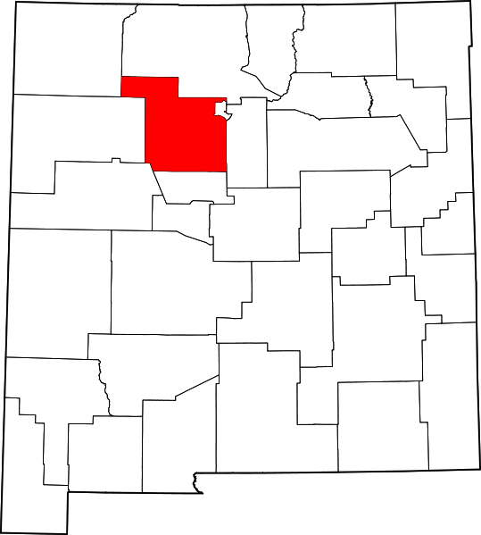
- Locator map showing Sandoval County — in northwestern New Mexico.
David Benbennick made this map. For more information, see Commons:United States county locator maps. Or see any of the New Mexico county locator maps: Bernalillo · Catron · Chaves · Cibola · Colfax · Curry · De Baca · Doña Ana · Eddy · Grant · Guadalupe · Harding · Hidalgo · Lea · Lincoln · Los Alamos · Luna · McKinley · Mora · Otero · Quay · Rio Arriba · Roosevelt · Sandoval · San Juan · San Miguel · Santa Fe · Sierra · Socorro · Taos · Torrance · Union · Valencia.
| I, the copyright holder of this work, release this work into the public domain. This applies worldwide. In some countries this may not be legally possible; if so: I grant anyone the right to use this work for any purpose, without any conditions, unless such conditions are required by law. |
łahgo ádaalyaaígíí
Ńtʼę́ę́ʼígíí yíníʼį́įgo biniiyé, naʼalkid/yoołkáłígíí bikáaʼgi "click" ádíílííł
| naʼalkid/yoołkáłígíí | thumbnailígíí | naaniigo/náásee | Choyoołʼįįhí | haneʼ | |
|---|---|---|---|---|---|
| kʼadígíí | 15:31, 12 Atsá Biyáázh 2006 | | 5,677 × 6,312 (31 KIIŁTSOHʼÍÍŁKÉ) | David Benbennick | {{subst:User:Dbenbenn/clm|county=Sandoval County|state=New Mexico|type=county}} |
''Wikiibíídiiya'' bikáaʼgi choolʼį́/yitʼį́
(eʼelyaaígíí doo choolʼį́į da)
ałʼąą dineʼé bizaadjí
- ar.wikipedia.org bikáaʼgi
- كوراليس (نيومكسيكو)
- ريو رانتشو (نيومكسيكو)
- مقاطعة ساندوفال (نيومكسيكو)
- جيمز سبرينغز (نيومكسيكو)
- سان يسيدرو (نيومكسيكو)
- كوبا (نيومكسيكو)
- إدغوود (نيومكسيكو)
- محمية نافاجو
- سانتو دومينغو بويبلو (نيومكسيكو)
- سانتا آنا بويبلو (نيومكسيكو)
- سان فيليبي بويبلو (نيومكسيكو)
- بينيا بيانكا (نيومكسيكو)
- زيا بويبلو (نيومكسيكو)
- سان إلديفونسو بويبلو (نيومكسيكو)
- بيرناليلو (نيومكسيكو)
- لا جارا (نيومكسيكو)
- جيمز بويبلو (نيومكسيكو)
- قالب:مقاطعة ساندوفال (نيومكسيكو)
- bg.wikipedia.org bikáaʼgi
- bpy.wikipedia.org bikáaʼgi
- ca.wikipedia.org bikáaʼgi
- Sandia
- Pueblo Jemez
- Cochiti
- San Felipe Pueblo
- Kewa Pueblo
- Zia
- Santa Ana Pueblo
- Kawaik
- Algodones
- Bernalillo
- Cuba (Nou Mèxic)
- Edgewood (Nou Mèxic)
- Jemez Springs
- La Jara (Nou Mèxic)
- Pena Blanca
- Placitas
- Ponderosa (Nou Mèxic)
- Pueblo of Sandia Village
- Regina (Nou Mèxic)
- Rio Rancho
- San Ysidro
- Nació Navajo
- Plantilla:Comtat de Sandoval
- Reserva índia Santa Clara
- Jicarilles
- cdo.wikipedia.org bikáaʼgi
- ceb.wikipedia.org bikáaʼgi
- ce.wikipedia.org bikáaʼgi
- cy.wikipedia.org bikáaʼgi
View more global usage of this file.