
Eʼelyaaígíí:LocationDominica.png
higher resolutionígíí ádin.
LocationDominica.png (290 × 133 pixels - 4 KIIŁTSOHʼÍÍŁKÉ, MIME type: image/png)
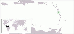
Location map for the Caribbean island-nation of Dominica.
Originally created for English Wikipedia by Vardion.
| |
This work has been released into the public domain by its author, Vardion, at the English Wikipedia project. This applies worldwide. In case this is not legally possible: |

|
File:LocationDominica.svg is a vector version of this file. It should be used in place of this PNG file when not inferior.
File:LocationDominica.png → File:LocationDominica.svg
For more information, see Help:SVG. |
 |
.
łahgo ádaalyaaígíí
Ńtʼę́ę́ʼígíí yíníʼį́įgo biniiyé, naʼalkid/yoołkáłígíí bikáaʼgi "click" ádíílííł
| naʼalkid/yoołkáłígíí | thumbnailígíí | naaniigo/náásee | Choyoołʼįįhí | haneʼ | |
|---|---|---|---|---|---|
| kʼadígíí | 17:58, 26 Wóózhchʼį́į́d 2006 | | 290 × 133 (4 KIIŁTSOHʼÍÍŁKÉ) | Stanmar | |
| 17:54, 26 Wóózhchʼį́į́d 2006 |  | 290 × 133 (4 KIIŁTSOHʼÍÍŁKÉ) | Stanmar | ||
| 02:31, 20 Níłchʼitsoh 2004 |  | 250 × 115 (9 KIIŁTSOHʼÍÍŁKÉ) | EugeneZelenko | Location map for the Dominica.<br/>Originally created for English Wikipedia by Vardion.<br/>{{PD}}<br/>Category:Country locator maps |
''Wikiibíídiiya'' bikáaʼgi choolʼį́/yitʼį́
(eʼelyaaígíí doo choolʼį́į da)
ałʼąą dineʼé bizaadjí
- ar.wikipedia.org bikáaʼgi
- arz.wikipedia.org bikáaʼgi
- azb.wikipedia.org bikáaʼgi
- ba.wikipedia.org bikáaʼgi
- be-tarask.wikipedia.org bikáaʼgi
- be.wikipedia.org bikáaʼgi
- bg.wikipedia.org bikáaʼgi
- bn.wikipedia.org bikáaʼgi
- bo.wikipedia.org bikáaʼgi
- bpy.wikipedia.org bikáaʼgi
- bs.wikipedia.org bikáaʼgi
- ceb.wikipedia.org bikáaʼgi
- ckb.wikipedia.org bikáaʼgi
- da.wikipedia.org bikáaʼgi
- de.wiktionary.org bikáaʼgi
- dsb.wikipedia.org bikáaʼgi
- ee.wikipedia.org bikáaʼgi
- el.wiktionary.org bikáaʼgi
- en.wikipedia.org bikáaʼgi
- Geography of Dominica
- User:DanielZM/test
- User:TheGrappler/North America directory
- LGBT rights in Dominica
- Outline of Dominica
- Index of Dominica-related articles
- United Nations Security Council Resolution 442
- Anolis oculatus
- Dominican ground lizard
- List of amphibians and reptiles of Dominica
- List of non-marine molluscs of Dominica
- en.wikivoyage.org bikáaʼgi
- eo.wikipedia.org bikáaʼgi
- eo.wiktionary.org bikáaʼgi
- es.wikipedia.org bikáaʼgi
- es.wikinews.org bikáaʼgi
- eu.wikipedia.org bikáaʼgi
- eu.wiktionary.org bikáaʼgi
- ext.wikipedia.org bikáaʼgi
- fa.wikipedia.org bikáaʼgi
- fiu-vro.wikipedia.org bikáaʼgi
View more global usage of this file.